Tech edge taken for advanced forest scan
 Drones, laser scanners, planes and sharp shooters have been put to work in the Tasmanian forest to better understand the environmental effects of forest management regimes.
An expert team has spent a week in the field capturing 3D scans, leaf samples and aerial images of a twenty five square kilometre area known as the Warra Tall Eucalypt SuperSite.
Researchers from The University of Queensland worked with CSIRO, Forestry Tasmania and the University of Tasmania gathered to comprehensively measure the site using multiple means.
“These forests are among the most productive ecosystems in the world and their management generates a high level of social and political interest,” UQ‘s Dr Peter Scarth said.
“By consistently monitoring and comparing structural and biodiversity indicators across the World Heritage and State forest areas, we can determine the long-term effects of forest management regimes and measure how environmental change is affecting the forest.”
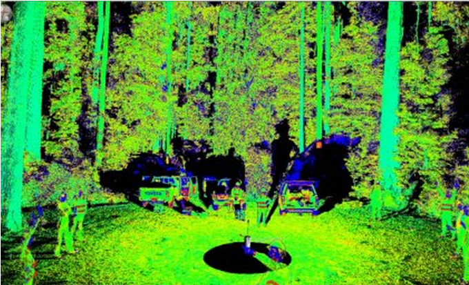
The team used advanced laser scanners to capture the 3D structure of the forest down to individual leaf detail; an Unmanned Aerial Vehicle (or drone) to collect infrared images which allowed them to distinguish between tree species; and a tree climber and sharp shooter to collect sample leaves from high in the canopy to study the chemical composition.
“Parts of this forest have remained unburnt for over 150 years, but other sites have been burnt in more recent times giving us a useful comparison to understand the effects of fire management,” Dr Scarth said.
The project was supported by the Terrestrial Ecosystem Research Network, which manages 10 ‘SuperSites’ - areas which represent significant ecosystems - across Australia.
These sites are consistently monitored to detect changes to flora, fauna and environmental processes in order to understand the response of these ecosystems to environmental change.
More information will be available on Dr Scarth’s blog.


 Print
Print