


Better sensors for sediments
 Print
Print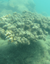 New tools are being developed to help manage one of the biggest threats facing the Great Barrier Reef.
That threat is pollution from land, which makes its way downstream by way of the many rivers and streams that flow into coastal waters along the reef .
The Great Barrier Reef is enormous – stretching 2,300 kilometres along the Queensland coast – so it is extremely hard to get an idea of what is happening in real-time.
“At present, there are less than 50 long-term river monitoring stations providing information that informs programs related to the protection of the Great Barrier Reef. That means there are thousands of kilometres of coastal lands and waterways where we have limited information,” said Dr Catherine Leigh from the ARC Centre of Excellence for Mathematical and Statistical Frontiers (ACEMS).
Now, Queensland researchers have developed statistical predictive tools that could lead to the deployment of many more low-cost sensors in those rivers and streams.
At this stage, low cost sensors are not yet able to show the two things that are most important in determining water quality - direct measures of sediments and nutrients.
Sediments can smother plants and animals. Nutrients are important for life, but an imbalance can lead to a variety of problems.
However, the low cost sensors can measure turbidity and conductivity. Turbidity is a measure of water clarity, and conductivity reflects the levels of ions like salt in the water.
In research just published in PLOS One, the ACEMS team developed statistical tools to take that turbidity and conductivity data and predict levels of sediments and nutrients in the water.
“They’re really the key things water agencies are looking for, both in what their values are and how they are changing over time,” said Dr Leigh.
The sensor data was provided by the Water Quality and Investigations (WQI) Team with the Queensland Department of Environment and Science.
By being able to predict levels of sediment and nutrients, managers can look toward automating the sensor process.
“Right now, someone has to physically go to where the monitoring station is, get a sample, take it back to a lab and test it. If we can automate this process with the sensors, we can get a lot more frequent predictions of what’s happening,” said ACEMS’ Dr Sevvandi Kandanaarachchi.
“Predicting these quantities is important because if they suddenly change, then that’s an indication that something with the system needs to be looked into.”
Dr Leigh hopes the project will lead to the deployment of many more low-cost sensors. She also says they are looking into developing an app that farmers and other landowners can use.
“They’re keen to make sure they’re not wasting nutrients, that what they use is taken up by the plants on the land and not end up in a stream,” said Dr Leigh.
“They’re also keen to reduce land erosion.”
The next stage of research will help answer questions like where to place the sensors, how many are needed in certain places, and whether they need to be moved around.